

LH Hiking Trail celebrates golden anniversary
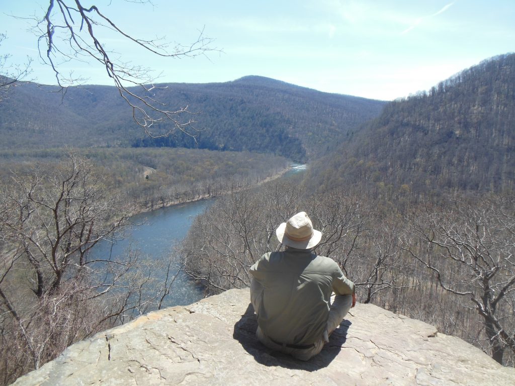
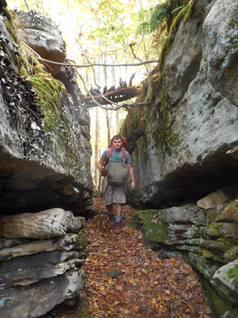
The Laurel Highlands Hiking Trail (LHHT) tracks the spine of Laurel Ridge for 70 miles from Johnstown to Ohiopyle. This year marks the popular path’s 50-year anniversary.
The next time you’re around Johnstown, heading south on Route 219 near Windber, look west (right) from the highway. You can’t miss what ignited the imagination of four friends from Johnstown in the 1960s. Dominating that view is a high, level-topped (from a distance) ridge slanting away to the hazy southwest, as far as you can see.
That soaring escarpment is the Great Laurel Ridge, a defining feature of Laurel Highlands topography. The four friends were Fred Thomas, Bruce Springer, Doug Corbin and James Mayer, and their imaginations conjured a hiking trail along that continuous crest.
In July 1968, the quartet scouted a route from Seward, outside Johnstown, for five days over rock outcrops, along ledges, through endless forest, and across headland streams, 70 miles south to Ohiopyle, Fayette County.
Their pioneering proved the route was not only visionary, but feasible. Inspired by the friends’ feat, the Western Pennsylvania Conservancy, state Dept. of Environmental Resources (now DCNR), and volunteers stitched together public lands, required rights-of-way, and backwoods labor to build the LHHT, the 70-mile path that traces the crest of Laurel Ridge from the Conemaugh River near Johnstown to the Youghiogheny River Gorge at Ohiopyle State Park.
The various partners completed the LHHT on Sept. 28, 1976, making this year the 50th anniversary of one of the region’s most significant outdoor assets.
“I think people are delighted to step away from constant travel in cars, and see things differently,” said Mike Mumau, division manager for the PA Dept. of Conservation and Natural Resources (DCNR), Bureau of State Parks. “Walking a trail over some distance lets you slow down and acquaint with landscape in a deeper sense. If you drive through a park, you might see beautiful sights, but experiencing a place on your own physical terms yields a greater appreciation for everything around you. The Laurel Highlands Hiking Trail offers that for a week-long journey or a few hours.”
Public access to a 70-mile footpath is not simple to cobble together. Along its course, the LHHT passes through state park land, state game lands, state forests, and private parcels including Seven Springs Mountain Resort and tracts owned by the Greater Johnstown Water Authority.
“Cooperation among these different agencies and private owners is central to the LHHT’s long-term viability,” Mumau said. “We (PA Bureau of State Parks) have excellent working relationships with the Game Commission, Bureau of Forestry, and private landowners. One mile of trail goes through Seven Springs. Its owners have changed over the years yet always understood how important this experience is to those who love the trail.”
Mumau said about 100,000 hikers use the LHHT every year for backpacking treks. That’s a documented number because distance hikers must register for overnight stays. “But we believe overall use is much greater,” he continued. “People use the trail for short day-hikes, or to cross-country ski, hunt or fish.”
Many who have hiked the LHHT note its unique blend of “wilderness” feel, with the relative comfort of weatherproof shelters. The “Adirondack-style” shelters, clustered at 10-mile intervals, offer stone fireplaces, dry places to sleep, drinking water and, often, dry firewood stacked nearby.
On a through-hike a few years ago, I encountered a group from Alabama who told me: “We hike all over the country, and these shelters make the Laurel Highlands Hiking Trail our favorite trail anywhere.”
At nearly 3,000 feet above sea-level, a fire in the massive stone fireplace, its warmth radiating into the structure, is a welcome comfort, even in summer.
Weather and use demand constant trail maintenance on the LHHT, a challenge in remote sections. Supported by volunteer help, DCNR Bureau of State Parks employees maintain the trail throughout its length.
“We have 170 footbridges on the trail,” Mumau said. “All made from native trees at-site and with a limited lifespan. We’re able to keep it safe because of backwoods ingenuity of our staff and network of volunteers, like Ridgerunners, who come up with something that works in challenging circumstances. It’s hard work with simple techniques, block-and-tackle, and special chainsaw accessories — low-tech, but serviceable.”
You don’t need to endure a 70-mile sojourn to enjoy the LHHT. The path crosses several roads, offering options for day-hikes of shorter length. Headed south-to-north you can reach trailheads at Maple Summit Road, Route 653 above Normalville, Route 31 east of Jones Miles, Route 30 east of Ligonier and Route 271 west of Johnstown.
Even long-distance traffic gets a glimpse of the LHHT where it crosses the PA Turnpike on a footbridge high above the highway between Donegal and Somerset.
A series of events are planned to celebrate the LHHT’s 50th anniversary. These include a 50th Anniversary Party at the Lake at Seven Springs Mountain Resort on July 18, and a Turnpike Bridge Celebration atop the turnpike bridge on Sept. 27. For details, visit GOLaurelHighlands.com.
“Among all our outdoor options here, the LHHT is right at the top,” said Eric Knopsnyder, director of public relations and community outreach for Go Laurel Highlands. “It showcases the beauty and diversity of our region. You are going to see so many wonders over that 70 miles, boulder formations, overlooks, streams and a lake. It’s the best way to grasp what a gem we have in our Laurel Highlands.”
Ben Moyer is a member of the Pennsylvania Outdoor Writers Association and the Outdoor Writers Association of America.